Ground stations are a critical part of every satellite network. They provide the physical connection between spacecraft in orbit and users, operators, and data systems on Earth. Their core purpose is to transmit and receive information reliably while maintaining sufficient signal quality.
For Low Earth Orbit (LEO) satellites, this role is especially demanding. Unlike geostationary satellites, which appear fixed in the sky, LEO satellites move rapidly relative to the ground. Their speed, short visibility windows, and growing numbers require ground stations to operate with high precision, extensive automation, and increasingly flexible network architectures.
Ground Station Architecture
A typical ground station contains several interconnected subsystems that support either the uplink, which sends information to a satellite, or the downlink, which receives information from it.
The downlink begins with a highly directional antenna that receives the satellite’s relatively weak signal. A Low Noise Amplifier strengthens that signal while adding as little additional noise as possible. A downconverter then translates the high radio frequency into a lower intermediate frequency, making the signal easier to process. Finally, a demodulator extracts the transmitted data.
The uplink performs the reverse process. A modulator prepares commands or data for transmission, an upconverter shifts the signal to the required satellite frequency, and a High-Power Amplifier increases its strength before it is transmitted through the antenna.
Ground stations also depend on several support systems. These include a stable power supply, monitoring and control software, antenna-tracking equipment, and mechanical drive systems. Safety equipment may also be necessary. For example, wind sensors can automatically move an antenna into a protected parking position during severe weather.
The Challenge of Tracking LEO Satellites
LEO satellites travel at approximately 7.2 to 7.5 kilometres per second relative to Earth. From the perspective of a single ground station, a satellite may be visible only six to eight times per day, with each pass lasting roughly five to fifteen minutes.
These short contact periods place significant demands on ground station equipment. The antenna must locate the satellite quickly, follow it accurately across the sky, establish a reliable communication link, transfer as much data as possible, and then prepare for the next pass.
Tracking is normally based on precomputed orbital information, often expressed through Keplerian elements or similar orbital parameters. Depending on the system, the antenna may need to maintain pointing accuracy of approximately half a degree.
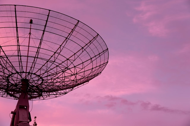
Traditional ground stations commonly use mechanically steered parabolic dishes. Motors physically rotate the antenna to follow the satellite. These systems can provide high gain and accurate pointing, but moving parts require maintenance and may limit how quickly the station can switch between satellites.
Newer systems increasingly use flat-panel or electronically steered antennas. Rather than moving the entire antenna, these systems steer their beams electronically. This can improve switching speed, reduce mechanical wear, and make it easier to support large constellations with frequent satellite passes.
Visibility and the Horizon Plane
A ground station can communicate with a satellite only while the spacecraft is within its usable field of view. This region is defined by the station’s horizon plane.
The ideal horizon begins at zero degrees of elevation, where the satellite would theoretically become visible at the geometric horizon. In practice, however, communication at such low angles is often unreliable.
Buildings, trees, terrain, and other obstacles may block the signal. The atmosphere also introduces greater losses when the signal travels at a low elevation angle because it must pass through more of the atmosphere.
For this reason, engineers define a practical or designed horizon. A station may be configured to begin communication only when a satellite rises above a predetermined minimum elevation, often somewhere between five and thirty degrees, although the exact threshold depends on the site and mission.
Using a higher minimum elevation shortens the available contact window, but it can improve signal quality, reduce atmospheric losses, avoid local obstructions, and lower uncertainty in the link.
Measuring Ground Station Performance
One of the most important measures of receiving performance is the station’s figure of merit, commonly expressed as G/T. This is the ratio between antenna gain and system noise temperature. A higher G/T value indicates that the station is more capable of receiving weak satellite signals.
Engineers also use a link budget to evaluate the performance of the entire communication path. A link budget accounts for every major gain and loss between the transmitter and receiver.
One of the largest losses is free-space path loss, which increases with both distance and frequency. The distance between the satellite and ground station, known as the slant range, changes throughout each pass. This means link quality may vary significantly as the satellite rises, moves overhead, and approaches the opposite horizon.
Weather can also affect performance. Rain attenuation becomes especially important at frequencies above approximately 10 GHz. Heavy rain can weaken a signal enough to reduce data rates or interrupt the link entirely.
Ground Station Networks
A single ground station can communicate with a LEO satellite only during brief local passes. Operators therefore need multiple stations in different geographic regions to increase contact opportunities.
A global ground station network allows satellites to download data more frequently, receive commands with less delay, and reduce the amount of information that must be stored onboard. This is particularly important for Earth-observation satellites, which may collect large volumes of imagery or sensor data.
Mega-constellations introduce an even greater operational challenge. Networks containing hundreds or thousands of satellites may generate thousands of communication sessions each day. Manually scheduling and operating each contact would be impractical.
Modern networks therefore rely heavily on automation. Software schedules satellite passes, reserves antennas, configures radios, establishes links, transfers data, detects faults, and prepares the equipment for the next contact. Many ground stations are unmanned and monitored remotely by relatively small operational teams.
Ground Station as a Service
Traditionally, satellite operators built, owned, and maintained their own ground station networks. This required substantial capital investment in land, antennas, radio equipment, network connections, licensing, and personnel.
Ground Station as a Service, or GSaaS, offers an alternative. Under this model, specialist providers operate shared networks of antennas and sell access to satellite operators on a pay-as-you-go basis.
A satellite company can reserve antenna time when one of its spacecraft passes over a provider’s site. The received data can then be transferred directly into the operator’s cloud or data-processing environment.
This approach can significantly reduce capital expenditure, particularly for small companies, universities, and early-stage missions. It can also give operators access to a geographically distributed network without requiring them to build infrastructure in multiple countries.
However, shared networks also introduce dependencies. Operators must consider antenna availability, scheduling conflicts, pricing, data security, service reliability, and compatibility with their spacecraft communication systems.
Cloud Integration and Virtualization
Ground stations are increasingly connected directly to cloud-computing platforms. Instead of treating the station as an isolated radio facility, operators are integrating it into a broader digital infrastructure.
In this model, the ground station receives the satellite signal and transfers the data directly into cloud storage or processing services. Automated workflows can then process imagery, analyse sensor readings, distribute products to customers, or feed information into terrestrial networks.
Some modern teleports therefore function more like data centres than traditional antenna sites. Their role extends beyond receiving radio signals to include computing, networking, cybersecurity, storage, and analytics.
This integration is especially valuable for LEO missions because the time between data collection and delivery is often commercially important. Automated cloud processing can reduce delays and allow users to access satellite data shortly after it reaches the ground.
Spectrum Licensing and Frequency Coordination
Ground stations are subject to national and international telecommunications regulations. Operators must obtain authorization to transmit and receive on specific frequencies.
Licensing requirements vary between countries, but they may include permits for the ground equipment, approval of antenna locations, authorization of transmission power, and coordination with other spectrum users.
Earth stations may also need to undergo frequency coordination to ensure that their transmissions do not interfere with terrestrial microwave systems or other satellite services operating nearby.
These requirements can affect where a station is built, which frequencies it can use, how much power it can transmit, and what technical protections it must implement.
Understanding Landing Rights
Landing rights are another important regulatory issue, particularly for international satellite services. In general, they refer to a country’s legal authorization for a foreign satellite system to provide signals or capacity within its territory.
Landing rights are distinct from licenses for the ground equipment itself. A company may need one authorization covering the satellite service entering the national market and separate licenses for gateways, antennas, or user terminals operating inside the country.
The term is not applied consistently around the world. Different countries use different legal mechanisms, including market-access grants, satellite operating licenses, foreign space-object registrations, and space-station frequency licenses.
The main purpose is to allow national governments to control which foreign satellite operators can enter their markets. Governments may consider competition, national security, domestic industrial policy, spectrum management, taxation, and communications sovereignty.
The Commercial Challenge of Landing Rights
Securing market access can be a significant challenge for LEO constellation operators. A global service provider may have to negotiate with dozens of national regulators, each with different laws, procedures, technical requirements, and political priorities.
Some countries may require a local business partner. Others may impose taxes, tariffs, licensing fees, coordination costs, or revenue-sharing conditions. These expenses can increase the final cost of satellite services.
National security can also influence access. Governments may be reluctant to permit foreign satellite systems when they are concerned about espionage, data control, interception, or dependence on overseas infrastructure.
Although only a minority of jurisdictions may use a formal process explicitly called “landing rights,” operators can still be regulated through broader telecommunications laws, business licenses, network authorizations, spectrum rules, and security requirements.
Different National Approaches
Countries regulate foreign satellite services in different ways.
In the United States, access may be granted through a market-access process based partly on whether the proposed service is in the public interest.
China may require a space-station frequency license, coordination with domestic satellite operators, and a strong local partnership.
India may use a satellite operating license and may consider whether local satellite capacity is available or whether the proposed foreign service provides particular national value.
Australia has used registration processes focused on identifying foreign space resources that may support national infrastructure.
Indonesia may require formal landing rights together with a local partnership.
These examples illustrate why global regulatory planning is essential. An operator cannot assume that permission in one jurisdiction will automatically be recognized in another.
The Future of the LEO Ground Segment
The ground segment is evolving rapidly as LEO constellations expand. Traditional antenna sites are becoming highly automated, cloud-connected network nodes capable of supporting many spacecraft and large volumes of data.
Electronically steered antennas may improve the ability to switch rapidly between satellites. Shared GSaaS networks may continue to reduce the cost of market entry. Cloud integration will allow operators to move more quickly from signal reception to data analysis and customer delivery.
At the same time, regulation will remain a major part of ground station planning. Operators must manage spectrum authorizations, equipment licenses, frequency coordination, local partnerships, and market-access requirements across multiple jurisdictions.
Ground stations may be located on Earth, but they are central to the success of every LEO mission. Without an effective ground network, even the most advanced satellite cannot deliver its data, receive commands, or provide a dependable service. As satellite constellations grow larger and more interconnected, the ground segment will become increasingly important to the performance, scalability, and commercial viability of space-based systems.